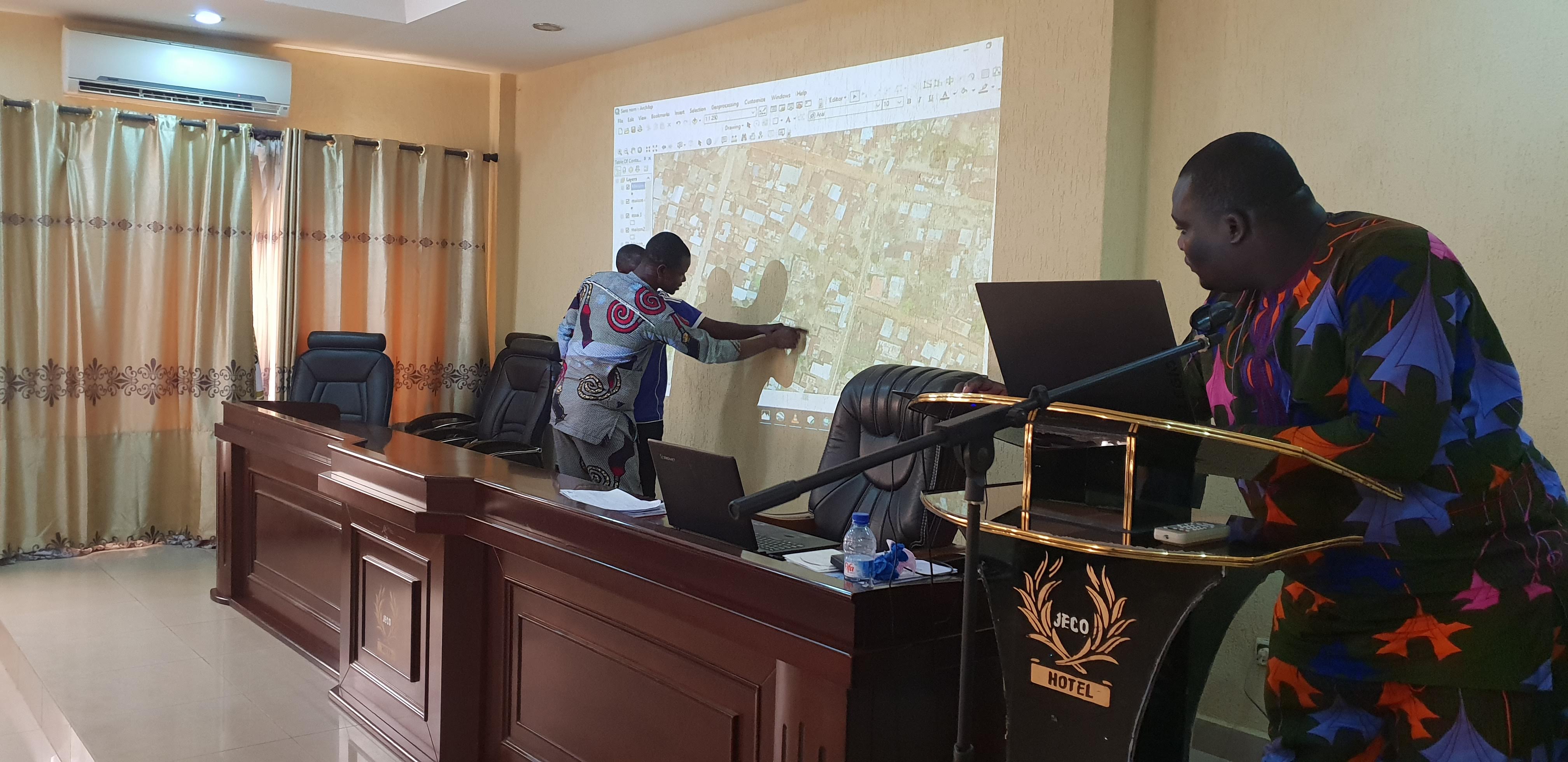
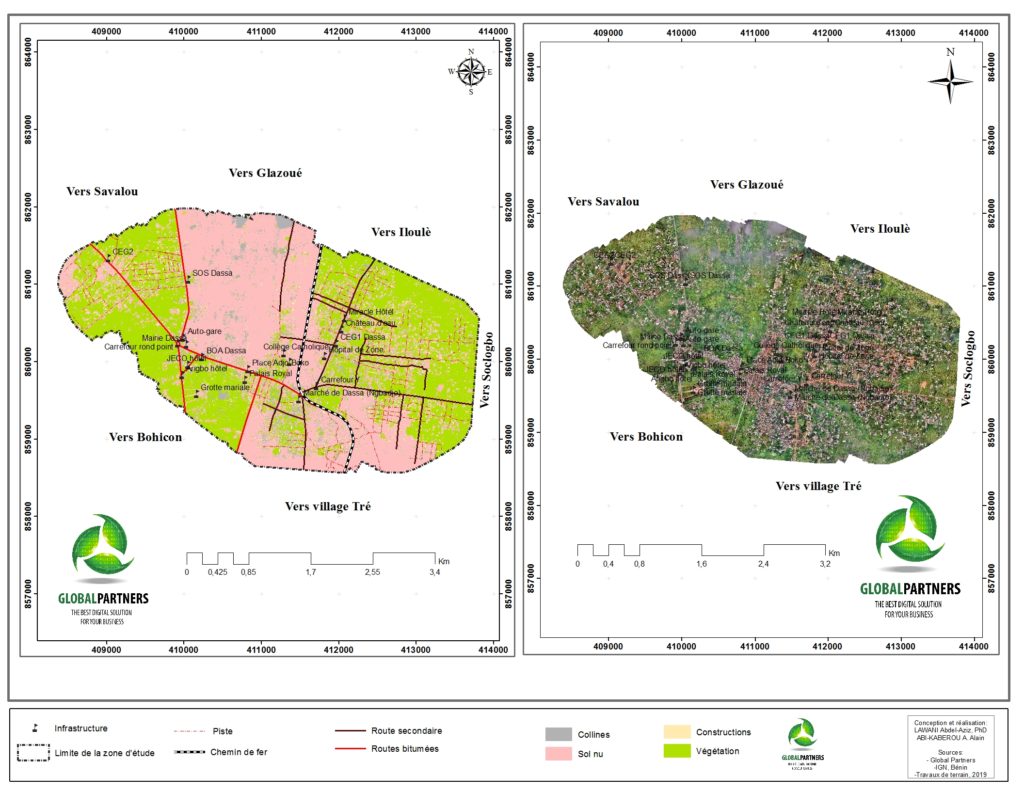
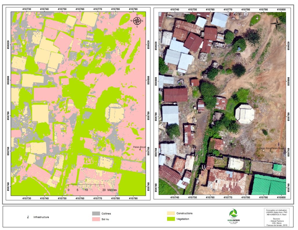
From October 21 to 24, a team of Benin Flying collected aerial images of the town of Dassa. More than 20GB of georeferenced images were collected. They were stitched to produce an orthomosaic map of the town. This map is condensed but contains valuable information that can provide useful insights to managers. However, examining each section of this map before gathering the information needed is inefficient. It is a time-consuming task that could take days and the manager might not deduct a clear pattern after his inspection. In this pilot project, we rely on a supervised classification (supervised machine learning) to identify common objects on the maps such as constructions, vegetations, roads, railroads, hills, and nude soils. Image 1 presents the results of the classification model and the original orthomosaic map. Figure 2 illustrates the same result but on a larger scale.
Recent developments in computer science have made available new techniques to analyze big data and derive the patterns that naturally occur in them. These techniques commonly called machine learning are a branch of artificial intelligence that group all the methods where computer learn from data, observe and evaluate patterns to make decisions without or with minimal human intervention. In parallel, the development of low cost unmanned aerial systems (drones) has also eased data collection, aerial surveys. A major constraint posed by drones is the limitation of the existing techniques to analyze the large volume of image data collected via drones. Making sense of these big data will provide valuable information that can be used to address critical issues faced by communities. However, artificial intelligence in general, and machine learning, in particular, can address the challenges posed by the analysis of drones’ big data.
The present pilot project tests how drones can be combined with machine learning tools for urban planning. Conducted by Benin Flying Labs, the main objective of this pilot project is to provide municipalities with accurate and update data about their communes. These data can, in turn, serve in urban planning and address issues such as soil erosion, land management, monitoring of roads construction, waste management and their impact on health. Benin Flying Labs is a space created by three organizations, WeRobotics, Global Partners, and Agence pour le Developpement du Numerique (ADN). WeRobotics is a not-for-profit organization that promotes the use of robotics for good. WeRobotics co-creates a global network of local knowledge hubs, the flying labs, in emerging economies. Global Partners is a Benin-Based startup that develops and provides drones services for agriculture, urban-planning, and biodiversity conservation. Global Partners brings its technical and scientific expertise to the Benin Flying Labs. ADN implements the Benin government ambition to become, by 2021, the digital services platform for all of West Africa and to make information and communication technologies the main lever for the country socio-economic development. ADN provides the institutional support to the Benin Flying Labs.
The results show that the machine learning model can classify or categorize the different objects on the orthomosaic generated from the images collected with the drone. The results of the digital image classification are highly accurate. The results of this pilot project also confirm that machine learning techniques can be used to quickly analyze large volumes of drones’ data. Using these techniques, managers at the local level, can quickly gain insights from the data collected with the drones and address the issues their constituents are facing. However, a challenge remains: how can the managers be trained to use these techniques. At Global Partners, we believe this service can be provided by youth who get the training and develop the skills needed to analyze drone’s data.
This blog-post is part of a research project being conducted by Global Partners. The research team is comparing machine learning performance with drones and satellite data. This research aims at providing scientific evidence on the extent to which drones can replaced satellite data in addressing needs at the local level.
