In Benin, nearly 70% of the population directly or indirectly depends on agriculture. To increase the contribution of the agricultural sector to Benin’s economy, the government has developed a strategic plan that promotes the development of key agricultural value chains among which pineapple. Pineapple is the major fruit crop and an important source of employment and export income in southern Benin. To support the Benin government strategic plan, Enabel, the Belgium development agency, is implementing the “Development of Entrepreneurship in the Pineapple Sector” (DEFIA) program in Benin. One of DEFIA’s objectives is to introduce the use of drones for extension services to benefit pineapple producers. Pineapple farming systems in Benin are extensive, with increasing reduced productivity, efficiency, and yields.
In collaboration with Enabel and the Benin Ministry of Agriculture, Global Partners has developed AI and drone-based solutions to boost productivity in pineapple farms. Global Partners is a Beninese enterprise that develops digital solutions in several sectors. In agriculture, the enterprise combines drones with other digital technologies and artificial intelligence to support farmers and the farm service sector. As part of its collaboration with Enabel and the Benin Ministry of Agriculture, Global Partners has developed two solutions for precision agriculture in pineapple farming systems: Drone4Ag and Nana.
DRONE4AG: An application for aCCURATE AND FAST DIAGNOSTIC on pineapple farms
Pineapple production occupied agricultural lands over a period of 20-25 months to produce the fruit and its suckers. To accelerate the crop production cycle, farmers artificially induce plant flowering. Artificial flowering induction (AFI) allows farmers to reduce the pineapple production cycle by an average of 196 days compared to pineapple with natural flowering induction (NFI). The flowers are the precursors of the fruits, and flowering is crucial for the development of pineapples. Identifying gaps in flowering allows farmers to target problem areas with flowering-inducing chemicals (e.g., ethephon and calcium carbide). Using AFI additional fruits are grown increasing yield. This process facilitates the synchronization of cultural practices and reduces the number of harvesting and the cost of production. Using AFI also allows farmers to cultivate additional crops such as maize (Zea mays) that has a crop cycle of 75–90 days (early-maturing cultivars) in Benin and/or legume crops such as cowpea (Vigna unguiculata) that has a crop cycle of 90 days.
AFI occurs in the middle of the crop vegetative cycle and pineapple farmers have to scout their farms to locate the non-flowering plants to apply the AFI. However, scouting pineapple farms presents several challenges. One risk is the frequent wounds associated with the sword-like pineapple leaves. The leaves have on their edge sharp and upcurved spines that frequently wound workers in the pineapple field. The field conditions are deterring and make scouting challenging during the growing season.
To address the double challenge posed by the difficult access to pineapple fields during the growing season and scouting to identify and localize the non-flowering plants, Global Partners developed an algorithm that combines drone imagery with AI services to help pineapple farmers easily identify and locate the non-flowering plants. The drone facilitates remote access to the field (no wounds) and the AI permits automatic detection and location.
The algorithms were developed over two years. To have a heterogenous sample that informs on the diversity of the pineapple farms, Global Partners worked directly with a sample of 200 farmers. Using the DJI Phantom 4 with a multispectral sensor, data was collected at different heights to develop computer vision algorithms.
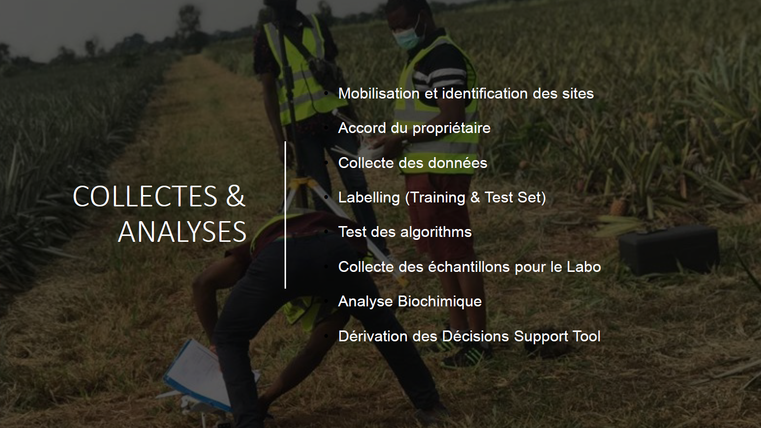
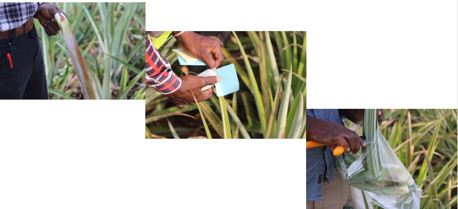
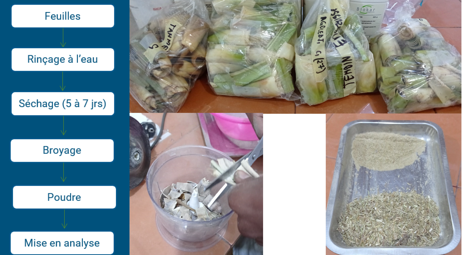
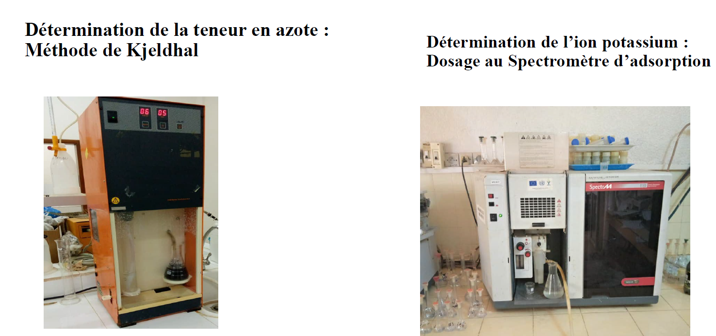
Samples of pineapple leaves were also collected alongside their spectral signature. The samples were then analyzed to estimate their contents in nitrogen and potassium, the two nutrients whose deficiency affects pineapple farms in South Benin. These data help develop a stress model.
To develop each algorithm, the data collected was split into training and test sets. The training set was used to estimate the different parameters of the model while the test set helps evaluate the performance of the trained model.
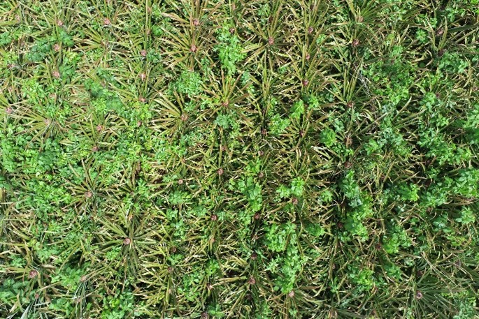
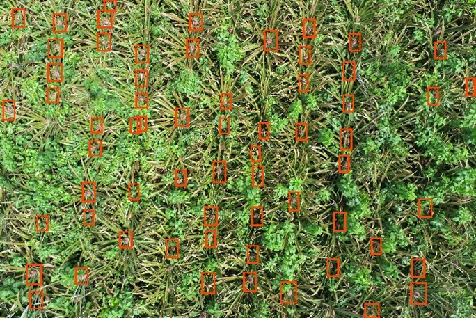
The images below illustrate the result of using a computer vision algorithm on a drone image collected on a pineapple farm to identify and localize the inflorescence.
Farmers access the services via extension agents. Near real-time crop diagnostics is used by extension service providers to assist farmers in increasing production and return to investment via precision agriculture practices.
In addition to the detection of flowering, the algorithm also facilitates the counting of pineapple fruits. For pineapple farmers, being able to count the number of fruits to be produced helps them have an accurate estimate of their yield, make investments decision, and secure loans as it is a good indicator of future revenue.
The drone and AI solution is packaged as a desktop application and delivered to pineapple farmers by extension agents trained by Global Partners. The solution assists extension agents in delivering, location-specific, and real-time advice to pineapple farmers using the results generated by the AI algorithms. The image below presents the desktop application that shows the results from passing the drone images through the computer vision algorithm. Farmers have a counting of the number of inflorescences in the field, coupled with a classification of the field in homogenous areas based on the number of inflorescences. This indicates to farmers the areas that need more attention.
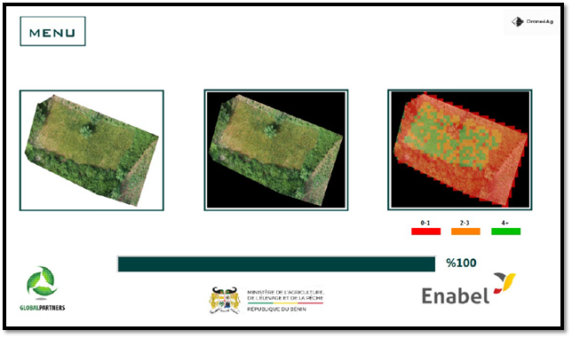
Finally, the result can be projected directly on a map where farmers can walk in their fields and address the non-flowering issue.
NANA: A DECISION SUPPORT TOOL FOR PINEAPPLE FARMING
Nana is a farm management application that allows farmers to better manage their pineapple farms.

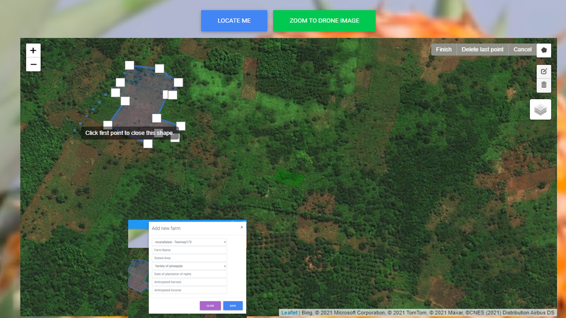
Farmers enter the list of their farms in the application. Using drone imagery of GPS coordinates each farm is mapped. Farmers are prompted to select the variety of crops planted on each farm.
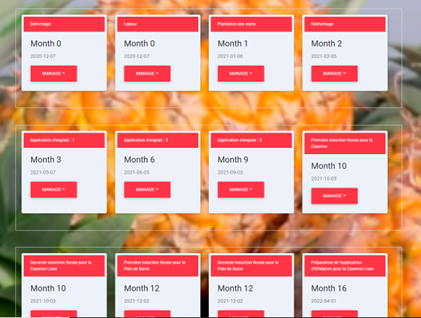
Using a couple of pieces of information such as the location of the farm, and the variety of pineapple planted, an algorithm automatically generates an agricultural calendar that informs the farmer of all the agricultural operations he will have to perform on his farm until harvest (figure 5).
Farmers are regularly notified via SMS messages when a task needs to be completed. If the farmer completes the task, he enters it in the app if not he reschedules the task, and the calendar automatically updates the remaining tasks.
Through Nana, extension agents can directly assist farmers. They document in the application the diagnostics and the type of services provided. This facilitates the evaluation of extension agents’ works.
The application also allows extension agents to monitor pineapple production in near real-time in a specific geographical area (municipality, department, or the entire national territory). The application makes it possible to generate statistics that can be used by the authorities at various levels, to make forecasts of harvests, producer incomes, quantities of fertilizers used, etc. These statistics can also be disaggregated by age, sex/gender, ethnicity, geographical location (at the level of the village, commune, district, department, etc.), etc. Data can also be exported as a geodatabase and analyzed using GIS software.
Precision agriculture has a lot of promise in the agricultural sector in Africa. Yet, their applications are still not legion. Global Partners is one of the few enterprises that combines drones and Artificial Intelligence (AI) to help farmers in rural West Africa benefit from precision agriculture. Drone4Ag and Nana are some examples of specific applications developed to boost productivity in pineapple farming systems.
